Witnessing Nature’s Fury: 10 Devastating Mudslides Captured on Camera
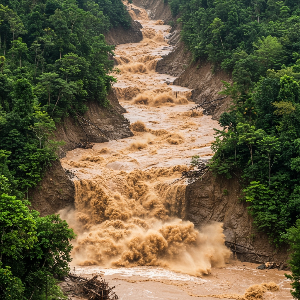
Mudslides, also known as debris flows or landslides, are among nature’s most powerful and destructive forces. Triggered by heavy rainfall, earthquakes, or volcanic activity, they involve a rapid surge of soil, rock, vegetation, and water down a slope. While unpredictable and often occurring in remote areas, some of the most catastrophic mudslides have been witnessed and recorded, offering stark visual documentation of their immense power and tragic impact. This historical record highlights ten such devastating events, each captured on camera, serving as a sobering reminder of the risks posed by unstable terrain and extreme weather.

Notable Mudslide Events Caught on Film
-
- Oso, Washington, USA (2014): One of the deadliest landslides in U.S. history, a massive section of a hillside collapsed, engulfing the rural community of Steelhead Haven. Aerial footage and ground-level videos captured the sheer scale of the destruction, showing homes obliterated and the landscape dramatically altered. The event highlighted the vulnerability of communities built near unstable slopes.
- Sierra Leone (2017): Following torrential rains, a section of Sugar Loaf mountain collapsed near the capital Freetown, sending a torrent of mud and debris through residential areas. Amateur videos shared widely online showed the terrifying speed and volume of the flow, which buried hundreds of homes and resulted in over a thousand fatalities.
- Mocoa, Colombia (2017): Heavy rains caused several rivers to overflow simultaneously, triggering avalanches of mud and rocks that swept through the city of Mocoa. Security camera footage and harrowing mobile phone recordings captured the moment the walls of water and debris surged through streets, destroying buildings and claiming hundreds of lives.
- Vargas State, Venezuela (1999): Known as the “Vargas Tragedy,” this series of debris flows and mudslides followed weeks of intense rainfall. While not a single event, the cumulative impact was catastrophic. Some of the earliest widely circulated videos showed the incredible force of the mud and boulder flows inundating coastal towns.
- La Conchita, California, USA (2005): A section of a hill previously affected by a 1995 slide gave way after heavy rains, flowing into the small coastal community. Dramatic footage captured by residents and news crews showed the slow but unstoppable movement of the earth, burying homes and resulting in fatalities.
- Qizhou, Hubei Province, China (2008): Triggered by heavy rainfall, a large-scale landslide and mudslide destroyed a village. Footage from state media and residents documented the moment the hillside collapsed, illustrating the rapid onset and destructive path of the event.

- Rio de Janeiro State, Brazil (2011): Torrential downpours caused widespread flooding and numerous landslides across mountainous areas north of Rio de Janeiro. Helicopter footage and ground videos revealed entire hillsides collapsing, sending rivers of mud through towns and causing a massive death toll. The scale of the disaster was particularly visible from the air.
- Semeru Volcano, Indonesia (2021): Eruptions from Mount Semeru triggered pyroclastic flows and subsequent lahars (volcanic mudflows) as volcanic ash mixed with rain. Videos captured the fast-moving, hot mudflows engulfing villages on the volcano’s slopes, demonstrating the combined danger of volcanic activity and rainfall.
- Tejarcillos, Costa Rica (2010): A massive landslide occurred on a hillside, burying part of a highway and several homes. Dashcam footage from vehicles narrowly escaping the slide and aerial views provided a terrifying perspective on the scale and speed of the earth movement.
- Zhouqu County, Gansu Province, China (2010): Heavy rains triggered a devastating mudslide that swept through the county seat. Satellite images and ground-level videos showed the town buried under a thick layer of mud and debris, highlighting the immense volume of material transported by the flow.
These visual records are more than just documentation of destruction; they are crucial tools for understanding the mechanics of mudslides, improving early warning systems, and educating the public about the risks in vulnerable areas. They stand as somber testaments to the raw power of geological processes.
While capturing these events on camera provides invaluable data and raises awareness, it also serves as a stark reminder of the human cost. The footage often shows moments of terror, loss, and the overwhelming force of nature against which human structures offer little resistance. Studying these devastating events helps scientists and engineers develop better strategies for mitigation and preparedness in landslide-prone regions worldwide.